
Project Links
Katmai National Park & Preserve » Katmai National Park and Preserve Seeks Public Input on the Brooks River Corridor Permit System » Document List » Document Contents
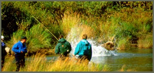
Brooks River Corridor Map
Map of the Brooks River Corridor. The Brooks River Corridor includes the river itself and 50 yards from the water's edge on either side along the banks from the Lake Brooks inlet downstrean to the elevated bridge and boardwalk. This does not include graveled roads and trails, boardwalks, or wildlife viewing platforms.
| Document Content: |
|
Disclaimer: Links within the above document(s) were valid as of the date published.
Note: Some of the files may be in PDF format and can be viewed using the Adobe Acrobat Reader software. You may download a free copy of Acrobat Reader from Adobe Systems. |